Langley SATCORPS group support for the Atlantic Tradewind Ocean-Atmosphere Mesoscale Interaction Campaign (ATOMIC) / Ocean-Atmosphere component of EUREC4A
Langley SATCORPS group support for the Atlantic Tradewind Ocean-Atmosphere Mesoscale Interaction Campaign (ATOMIC) / Ocean-Atmosphere component of EUREC4A
Langley SATCORPS group support for the Atlantic Tradewind Ocean-Atmosphere Mesoscale Interaction Campaign (ATOMIC) / Ocean-Atmosphere component of EUREC4A
NASA Langley support for ATOMIC-EUREC4A
GOES-16 Imagery Processed for ATOMIC-EUREC4A Field Experiment
Click to view latest satellite imagery
 GOES-E RGB
GOES-16 Cloud Products for ATOMIC-EUREC4A Field Experiment
Click to view latest product imagery
 GOES-E ZTOP
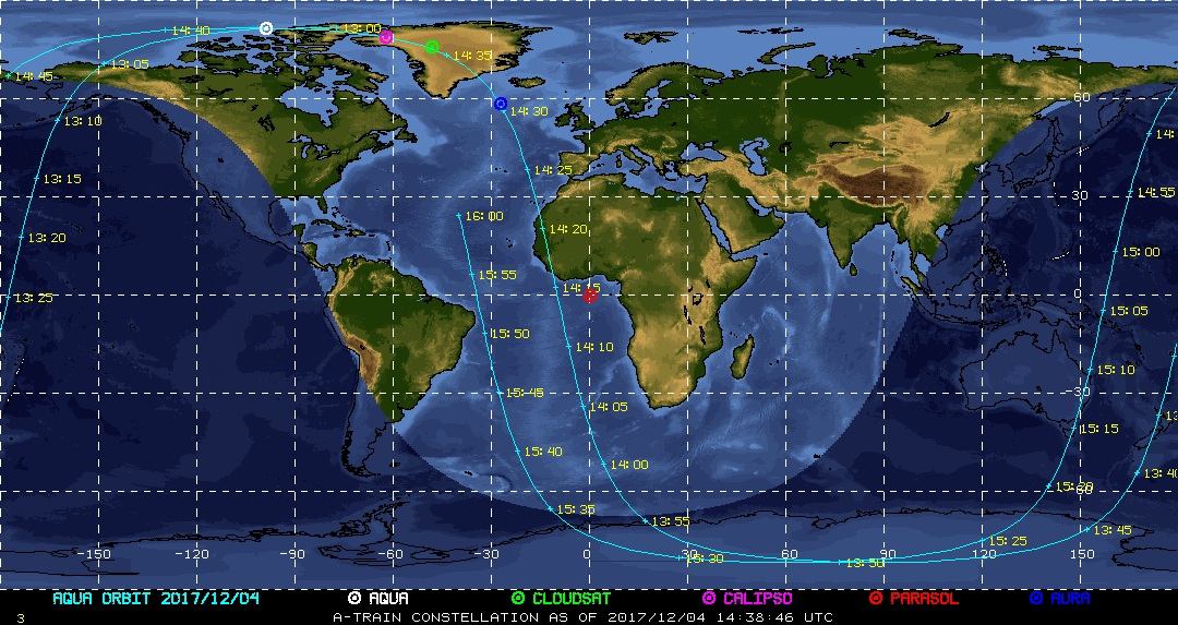
| Current Location of A-Train Satellites (updated every 30 sec) | ||
|

|
|
| A-Train | Calipso | CloudSat |
|
|
NASA Fact
NASA's Environmental Research Aircraft and Sensor Technology program (known as "ERAST") develops pilotless airplane technology. It also works on making science instruments very small so that they can be carried on remote-controlled aircraft.
- + Freedom of Information Act
- + Budgets, Strategic Plans and Accountability Reports
- + The President's Management Agenda
- + Privacy Policy and Important Notices
- + Inspector General Hotline
- + Equal Employment Opportunity Data Posted Pursuant to the No Fear Act
- + Information-Dissemination Priorities and Inventories
- + USA.gov
- + ExpectMore.gov
- NASA Official: William Smith
- Website Curator: Louis Nguyen
- + Contact Langley
- + Contact Team Members